
-1-300x221.png)
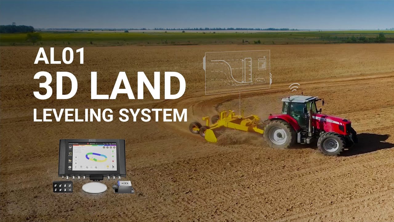
FJD AL01 3D Land Leveling System
Leveling for the Next-level Yield
Utilizing GNSS & RTK positioning technology and terrain design, the FJD AL01 3D Land Leveling System provides high-precision, effective and convenient solutions for farmland planning, reclaimation and leveling. Envisioning your next-level crop productivity, our leveling system offers you a smooth and even terrain with better water drainage and soil quality while saving your labor and resources.
GNSS-based Land Leveling System
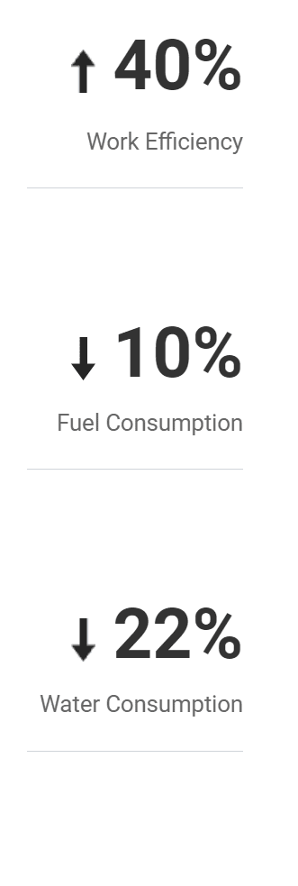
Say goodbye to the laser system’s troubling setup, limited signal coverage, and demanding weather conditions. Say hello to AL01, the GNSS-based land leveling system that achieves 2.5 cm accuracy¹, increases efficiency by 40%, and covers a larger area in comparison².
Terrain Design
Users can complete terrain design and earthwork analysis in simple ways and obtain terrain analysis, including fill-and-excavation and earthwork movement data. Our slope terrain design also trims topographic angles, facilitating better water management in your fields.
Functions
Terrain Survey
Our GNSS-based operations are the high-precision solution for field leveling that largely minimizes environmental disruptions while guaranteeing long-term accuracy. The features of our positioning technology — high-precision, extensive coverage, and real-time monitoring — make our leveling system perfect for diverse agricultural applications.
Height Calibration
Our system provides users with the convenience of performing elevation calibration directly from the terminal. This feature allows users to make necessary adjustments and produce fine-tune elevation data for a more consistent field surface.
File Transfer
AL01 supports the import of files in different formats (.kml, .ags, .txt, .csv, .etc.). The convenient integration of different data forms makes your work more effective, and more choices mean you can always select the most suitable and concise terrain data to guide your field tasks.
Record Reserve
Upon completion of a leveling task, the work record will be automatically saved to your task list. Therefore, you can easily avoid working on duplicate tasks or making manual errors simply by retrieving and reusing your task records in your next use.
Application Scenarios
Use FJD Land Leveling System to reclaim wasteland, consolidate and level fields, convert slopes into terraces, and optimize water usage for rice paddies.

Wasteland Reclamation

Land Consolidation
And Leveling

Customized
Slope Design
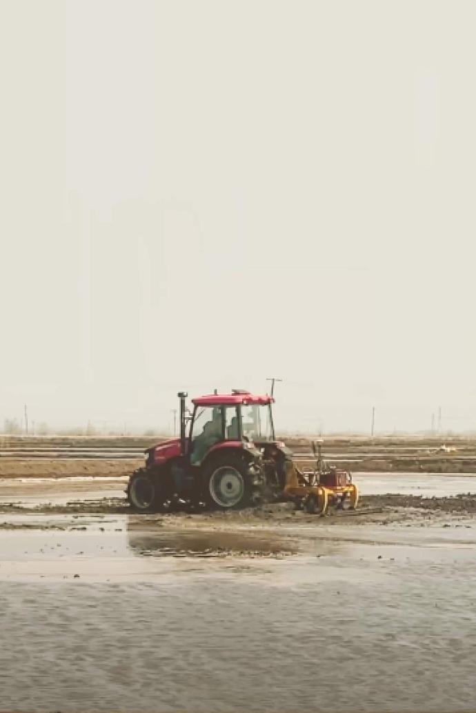
Paddy Field Work
Benefits
Accessory

A keypad can be mounted anywhere as required to provide accurate control in shaky or dusty cabs.
Price: Contact us
Back to FJD products