Case studies by crop · Precision farming
Plant stand count: corn, sunflower, sugar beet
DJI Agriculture case study, collected by FLYDROPS.
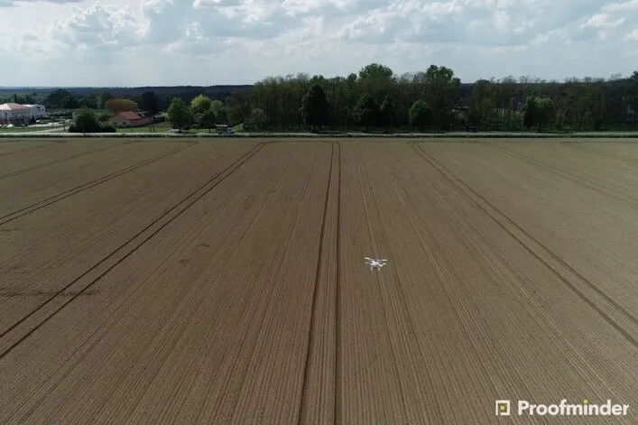
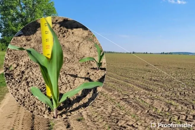
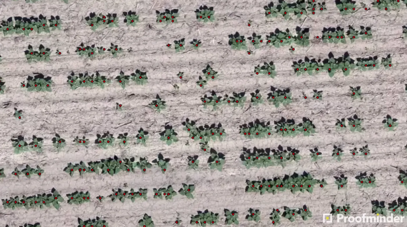
Counting plants shows whether sowing worked and where action is needed, before it is too late. With a drone carrying an RGB camera and an AI platform, the study by DJI, Proofminder and the distributor Duplitec (Hungary) reports 90–99% accuracy, in hours rather than days.
At a glance
| Crops | Corn, sunflower, sugar beet (and other field crops, vegetables, trees) |
|---|---|
| Drone | DJI Phantom 4 Pro V2.0 or Phantom 4 RTK; RGB camera |
| Resolution | 0.8 cm/pixel or better |
| Platform | Proofminder (AI) |
| Partners | Proofminder, Duplitec (DJI distributor in Hungary) |
The challenge
Manual counting covers small areas and is laborious and inaccurate: the numbers do not represent the whole field and problem zones with uneven emergence or weeds go unnoticed. The result is wasted resources and decisions made on little data. An accurate count matters when checking sowing quality, estimating yield early or deciding on partial resowing.
What was done
The guide gives practical advice for capturing the images:
- When: when the plant is visible from above but its leaves do not touch the next one. For corn, 3–7 leaves (V3–V7).
- Height and speed: fly at 18–30 m, at 3–5 m/s.
- Overlap: 75% front and side is a safe value.
- Weather: stable, with little wind, and watch the exposure (overexposure is worse than underexposure).
- Coverage: about 25–30 ha a day with a Phantom 4, if there are enough batteries; a 64 GB card for about 40–50 ha.
Common mistakes include wrong exposure, wind, too few batteries, flying after rain and inadequate planning for height differences.
The results
| What the platform gives | Detail |
|---|---|
| Count accuracy | 90–99% (per the guide), against a manual count that does not represent the whole field |
| Per-plant detection | Each plant is marked with coordinates; plant and row density |
| Additional findings | In the study’s corn, wild boar damage was found that the manual count had missed |
| Export | Shapefile export to compare with sowing data |
The numbers come from the study and relate to that specific application.
In the same series, a second article shows the same method in sugar beet, at a large grower in Hungary, with 90%+ accuracy for spacing and gaps: read it on ag.dji.com.
What it means for Greece
Corn, sunflower and sugar beet are all grown in Greece, mainly in Thessaly, Macedonia and Thrace. The method is not spraying; it is mapping, and it relies on the same drone you can also use for multispectral analysis. Today our multispectral drone is the Mavic 3 Multispectral, and the Phantom 4 RTK for high positioning accuracy. The analysis in the study runs on an external platform (Proofminder); what matters here is how the images are captured.
Rules and responsibilities
The study is about fertilizing and mapping, not plant protection products. Drone flights are always subject to the competent aviation authority’s rules; check the requirements before you plan work in your own field.
See also
Want to see what this means in your own field? Request a quote or call (+30) 2391 301149 and we will recommend the right setup.
DJI Agriculture case study, “High-precision Plant Stand Count for Corn, Sunflower and Sugar Beet by a Drone and AI” (8 October 2022). Translated and adapted by FLYDROPS. Results depend on the conditions of each field. Read the original.
See also
Application case studies by crop
Contact
Let’s talk about your fields.
Tell us what you grow and what you want to achieve. We’ll recommend the right equipment and send you a quote.